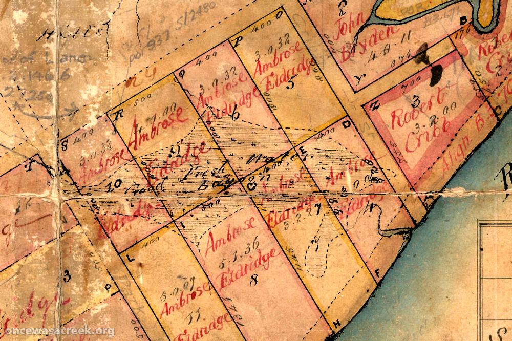
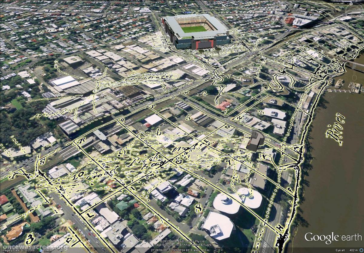
If you’ve read my earlier post about the Waters of Milton, then you will have already encountered this story, but I’d like to give it a post of its own. It’s the story of a lagoon that existed in the area bounded by Cribb Street, Park Road, Coronation Drive and the railway line — just outside the catchment of Western Creek. The lagoon stretched diagonally across this area from just near the Suncorp Bank on Park Road to where Cribb Street meets Coronation Drive.
The image below shows how the lagoon was depicted by the surveyor James Warner in 1850 on what is possibly the earliest map of the area. Immediately below the map is a screenshot from Google Earth, into which I imported an overlay of Warner’s map. It doesn’t exactly stand out, but if you look closely you can see the lagoon stretched across the modern landscape. In the background, you can also see Boundary Creek snaking through the Coronation Drive Office Park and past Suncorp Stadium.


