Navigating the history of Norman Creek

While I continue to neglect my own website, I did recently find time to contribute to someone else’s. In collaboration with Trish FitzSimons, who recently produced a wonderful series of short films featured in the Museum of Brisbane’s Navigating Norman Creek exhibit, and with support from the Brisbane City Council’s Community History Grant, I contributed to two pages about the history of Norman Creek for the website of the Norman Creek Catchment Coordinating Committee, or N4C.

The first of these two pages explores a plan of Norman Creek drawn in 1839 by the government surveyor James Warner. This plan, held today by the Queensland Museum of Lands, Mapping and Surveying, is a real treasure. It traces the entire length of Norman Creek, from its headwaters in Mount Gravatt to its junction with the Brisbane River. Warner not only depicted the course and form of the stream, but also described the surrounding terrain and vegetation as it was before Brisbane had developed beyond the penal settlement at the site of the modern CBD. His plan links us to the natural history of what is now a highly urbanised catchment.

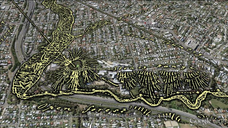
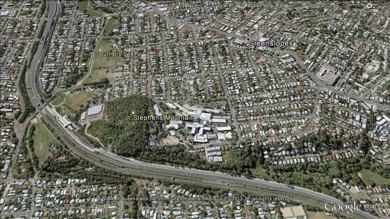
The page, Navigating Norman Creek: Maps from 1839 and 2015, provides a guided tour of Warner’s plan, using Google Earth (in combination with some other special magic) to show how the features on the plan correspond with today’s suburban landscape. The image below is just one example.

Warner sketched an open forest and a stoney range on either side of what is now the Pacific Motorway as it passes the Greenslopes Hospital. Downstream, he found a large swamp that has since become parkland.

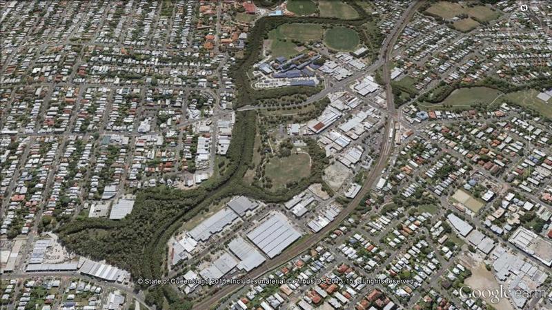
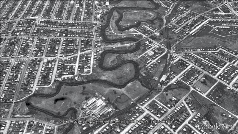
The second page explores another slice of Norman Creek’s history, this time via the 1946 aerial imagery of Brisbane. The image below, which will transition to the modern landscape if you hover your cursor on it (or touch it if you are using a mobile device), illustrates the level of modification that the creek has undergone since the middle of the 20th century.

The stretch of Norman Creek between Deshon Street and Stanley Street, Woolloongabba, was straightened during the early 1990s, with several meanders and sharp bends bypassed. Meanwhile, the previously cleared Moorhen Flats has been revegetated.

If you’ve been hanging out for some new content here at oncewasacreek.org, I hope these explorations of Norman Creek provide some satisfaction. I can’t promise any more material in the immediate future, but if you happen to be interested in the intersection between data visualisation and the study of public discourse, you might find more joy at my other blog, seenanotherway.com, which has just lurched back into life and is likely to get a lot more attention in the coming months as I enter the next phase of my PhD.

Dipping into the history of Norman Creek

It’s always good to learn that you are not alone in pursuing a particular passion. It’s a welcoming sign that you might not be crazy after all, or that if you are, you are at least in good company. The history of Brisbane’s creeks (extinct or otherwise) is not a topic that has received a lot of attention. This is, I’ll admit, partly why the topic appealed to me. But at the same time, I liked to believe that I wasn’t the only one spending so much time thinking about it.

This is why I was delighted to meet Trish FitzSimons and learn about her research into Norman Creek. Trish is a documentary film maker and social historian who has made two beautiful short films exploring Norman Creek and its place in the lives of people who have lived, and worked and played on its waters, its shores and its floodplain.

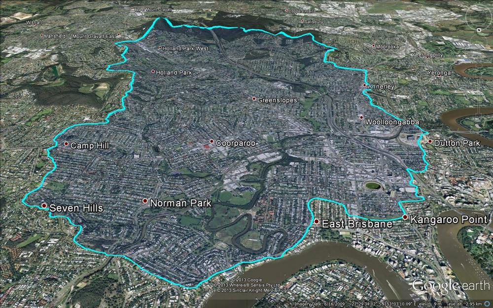
Unlike Western Creek, Norman Creek is not just a faded memory. It is still very much alive and flowing — at least in parts. Its mangrove-flanked lower reaches meander through the suburbs of East Brisbane, Norman Park and Coorparoo, but its catchment area extends all the way up to the slopes of Mount Gravatt.

The catchment area of Norman Creek.

The catchment area of Norman Creek. (Catchment boundary obtained from this map created by the Norman Creek Catchment Coordinating Committee.)

This is a creek that has seen its fair share of use, abuse, transformation and rejuvenation over the years. And yet its story, so rich in both social and natural history, is probably all but unknown to the many people who walk past or drive over it every day. Trish’s two films — Time and Tide: The Life of Norman Creek and Time and Tide: The Boat Builders of Norman Creek — reveal how the creek has supported industry, provided livelihoods, even inspired poetry. The films also highlight how the creek has in turn been shaped and transformed over the years by a community grappling with the legacy of floodplain development.

You can watch Trish’s films via the links on this page of the website of the Norman Creek Catchment Coordinating Committee. The films were made using support from the Lord Mayor’s ‘Helen Taylor bequest for Local History’, and they are an important contribution to the story of our city. Yet at the same time, they are but tantalising sips from a much deeper pool of history that is waiting to be explored. Trish tells me that she has many more stories to tell about Norman Creek, and that they might even feature in a public exhibition somewhere down the line. I can’t wait to dive in!

Where a creek begins

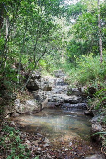
A pond in a tributary of Ithaca Creek, Mount Coot-tha. (February 2013)

A pond in a tributary of Ithaca Creek, Mount Coot-tha. (February 2013)

This is just a quick plug for a side-project of mine that has mostly sat on the back-burner since this website was conceived. Before I started mapping out Western Creek in my imagination, I had started to map out Ithaca Creek (a real creek!) photographically. My plan was (and still is) to photograph Ithaca creek from one end to the other, documenting its journey from the headwaters in Mount Coot-tha Forest through to the much more suburban surrounds of Red Hill where it joins its bigger brother, Enoggera Creek.

Ithaca Creek is a neighbour of Western Creek, sharing a catchment boundary along the ridge of Stuartholme Road, Simpson’s Road, Macgregor Terrace and much of Latrobe Terrace.

To see the Ithaca Creek photo-map, click here and then click on the small banner at the top of the page to go to the Picasa Web Album (Google appears to be phasing out Web Albums in favour of the happy-snap functionality of Google+, so I don’t know how long this will remain functional). Beneath the small map on the right-hand side of the album there is a link which takes you to a proper map view of the album.

Continue reading

There once was a house . . .

History can be told in so many different ways. I’ve chosen a buried suburban creek as my narrative thread. Magnus, a resident of Auchenflower, is using the renovation/restoration of his own house as a window to the history of his home and neighbourhood. His blog, A House in Auchenflower, delves into the history of the materials, the designs, and the people that have shaped his classic Queenslander and its suburban surrounds.

If you have any interest in the history and/or architecture of the Auchenflower area, this blog is well worth a look.