Picturing the past

If a picture says a thousand words, then today’s post should more than compensate for the lack of writing that I’ve done in recent weeks.

For a while now I have been collecting any historical photographs I can find of The Western Creek catchment and surrounding area. So far these are limited to those that have already been catalogued and digitised by the State Library of Queensland, the Queensland State Archives, the Brisbane City Council and the National Library of Australia. I like to think that there are still some more old photos out there, waiting to be dusted off and contributed to collections like these.

Rather than just post the photos I’ve collected into a standard gallery, I’ve done my best to determine where they were taken so that they can be put onto a map. The resulting map will live on this page under The Gallery, but the smaller version below provides a sneak-peak. You can navigate the map and click on the photos to view them.


View Western Creek History in a larger map

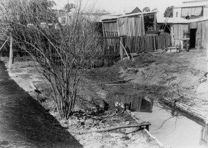
An open drain in a backyard at Ellena Street, c1905. (State Library of Queensland, Image no. 47486)

An open drain in a backyard at Ellena Street, c1905. (State Library of Queensland, Image no. 47486)

Among the highlights is the photo below from 1905, which shows a very sad and sorry looking creek bed flowing (according to the original caption) between Fernberg Road and Beck Street (then known as Mary Street). I suspect it was taken not far from Ellena Street, looking up towards Fernberg Road and Given Terrace. This creek bed could very well be the main channel of Western Creek. Another photo (see right) shows an open drain in a backyard in Ellena Street; I suspect this is also the main channel of Western Creek, just metres upstream of the other photo. Alternately, one or both photos could be of a tributary to the main channel. Whichever the case, these pictures neatly capture the fate of many waterways like Western Creek that stood in the path of early development. Besides these, I know of no other photos depicting the original channel of Western Creek.
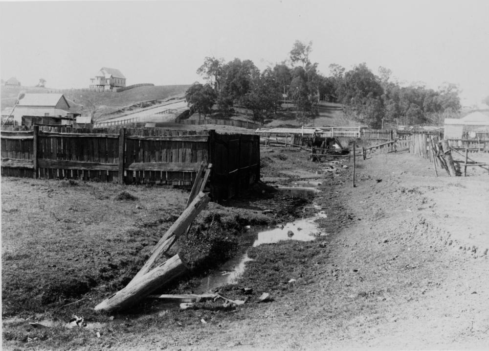
Old creek bed running between Fernberg Road and Mary Street, Paddington, ca. 1905. (State Library of Queensland, Negative no. 47487)
Old creek bed running between Fernberg Road and Mary Street, Paddington, ca. 1905. (State Library of Queensland, Negative no. 47487)

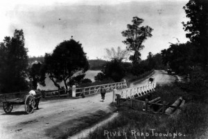
The Langsville Bridge at Auchenflower, ca. 1914. John Oxley Library, State Library of Queensland, Neg: 10579.

The Langsville Bridge at Auchenflower, ca. 1914. John Oxley Library, State Library of Queensland, Neg: 10579.

Also on the map are several photos of the River Road (Coronation Drive), including some of the bridge over Langsville Creek, which flowed through what is now Moorlands Park. Or perhaps some of these show the bridge over Western Creek instead — I confess that in some cases I am not sure, and I don’t trust some of the original captions either!

There are lots more that I could talk about, but instead I’ll leave you to explore the map yourself. If you spot a photo that you think is out of place, please let me know. And if you know of any photos that are not included, particularly from sources other than the ones I have used, I would love to see them.

Floods
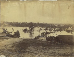
1893 flood taken from the Rosalie Torwood area looking towards old Bishopsbourne. (State Library of Queensland, Image number: 6288-0001-0001)

1893 flood taken from the Rosalie Torwood area looking towards old Bishopsbourne. (State Library of Queensland, Image number: 6288-0001-0001)

Not surprisingly, many of the surviving historical photos of this area were taken during floods, including those that occurred in 1890, 1893 and 1930. Several of these are on the map, but there are several others whose locations I have been unable to determine. I’ll make these the topic of a separate page or post in the near future.

Guppies & Geysers – Stories from the drains of Western Creek

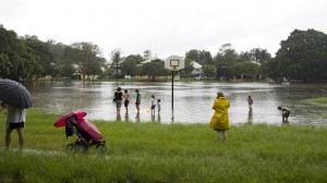
At about 10.30am on Saturday morning, a freak storm raced through Brisbane. The rain was so heavy that parts of Gregory Park went underwater, bringing back memories of the lead-up to the 2011 flood and reminding us again of this park’s swampy origins. Unfortunately I was not in a position to take any photos, given that I was viewing the scene through the window of an ambulance, having just broken my wrist after slipping on the flooded kitchen floor. But that’s another story.

Gregory Park starts to fill (January 11, 2011)

Gregory Park starts to fill (January 11, 2011)

Unlike in 2011, the water in Gregory Park on Saturday came not from the rising river (though the high tide certainly played a role), but from the stormwater racing through the catchment upstream. It’s easy to forget how much water gets channeled through the drains that are tucked away beneath our roads, footpaths and backyards. The fact that we so rarely think about them is a testament to how well these drains have been engineered: they’ve been sized to the right capacity, built to the correct gradient and constructed to withstand the pressure of the gushing water.

But that’s not to say that our drains were all built right the first time around. In the pages of The Brisbane Courier from the late 1800s and early 1900s there is no shortage of Council minutes and letters to the editor complaining of ineffective, faulty and smelly drains. And as you can read in this brand new page contributed by Steven Cowley, some drains in the area were still a work in progress even as late as the 1970s. Steven has recorded some wonderful stories recalled by his friend Rhonda, who grew up in Herbert Street in the 1970s. A brick drain used to run through Rhonda’s backyard, and in heavy rain the drain would often burst, sending geysers of water into the air. This was no doubt an exciting spectacle for a child, but a big nuisance for the council workers (and sometimes Rhonda’s father) who had to repair the damage.

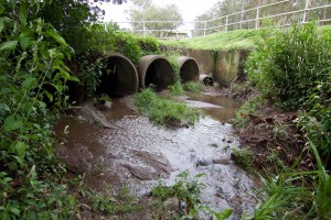
The drain pit in Norman Buchan Park, after rain. This was once a favourite spot for the kids of the neighbourhood.

The drain pit in Norman Buchan Park, after rain. This was once a favourite spot for the kids of the neighbourhood.

In drier times, the neighbourhood drains were also a place of exploration and discovery for Rhonda and her friends. The big pit in Norman Buchan Park was teeming with guppies, tadpoles, and even eels (I can verify that there are still eels in this drain!). The boys, being somewhat more adventurous — and much less sensible — than the girls, ventured some distance into the drain, getting as far as Gregory Park before the water got too deep and smelly. Rhonda now acknowledges how dangerous all this was, and advises against anyone doing it today. I find it interesting though, that without a creek to explore, kids often turn to the next closest thing: the drain that replaced it.

Rhonda also remembers the lower end of Western Creek before the old bridge was replaced and the banks were concreted over. ‘It used to be a place where you could sit’, she recalls. You could even catch a fish or crab for dinner.

The new page is called Guppies & geysers: memories of playing around and under Paddington in the 1970s. I am hoping that Rhonda’s stories will be familiar to some of you. I get the impression that exploring the drains in Norman Buchan Park was once something of a rite of passage for kids in this neighbourhood. Or perhaps you remember the old bridge and creek banks where Western Creek met the river. If you have any stories to tell or memories to share, I’d love to hear from you.

Exploring McKellar’s map in Google Earth

The fun with maps continues…

As detailed in last week’s post, I have recently been experimenting with ways of importing historical maps into Google Earth, which enables them to be explored from a whole new perspective. I initially did this for three maps, dating from 1843, 1859 and 1864. Today I’ve done the same for another map — Sheet 7 from a series of maps drawn by the government lithographer A.R. McKellar in 1895. This map shows the Milton Reach of the river and the area to the west up to Mount Coot-tha. You can see what the original version of this map looks like at the Queensland Historical Atlas.

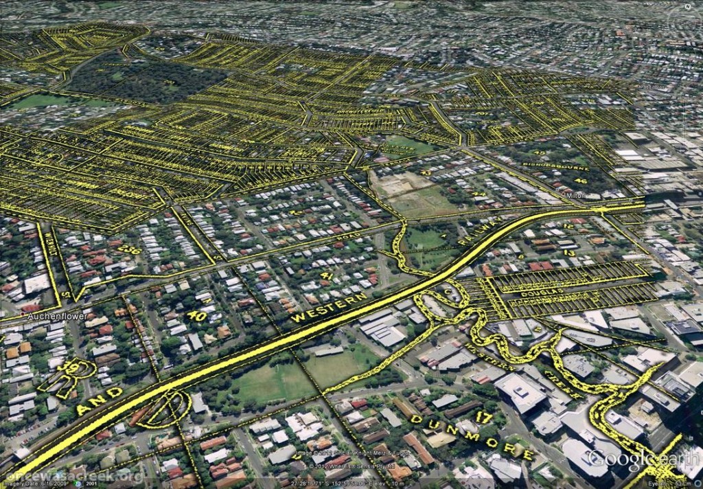
You would already be familiar with this map’s depiction of Western Creek — it is the one shown at the top of this page and all throughout this website. The picture below shows this same part of McKellar’s map in Google Earth. Dunmore Park is in the foreground, and Milton Park, Frew Park and Gregory Park can also be seen along the creek’s path.

Western Creek as depicted on McKellar's 1895 map, viewed in Google Earth.

Western Creek as depicted on McKellar’s 1895 map, viewed in Google Earth.

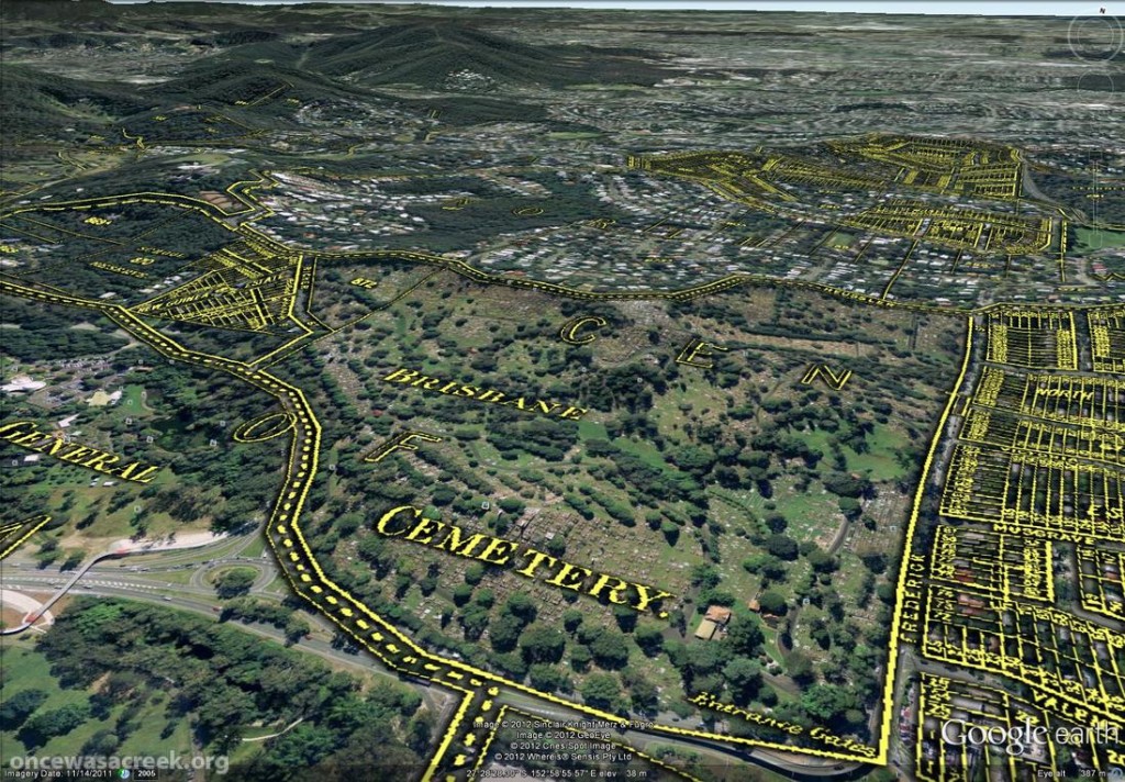
The image below shows the Toowong Cemetery. Beyond the cemetery, towards the upper right of the picture, is the area bounded by Boundary Road, Simpsons Road and Macgregor Terrace. This subcatchment of Western Creek is marked on McKeller’s map as the Lizzy Lee, Soudan and Rose Hill estates — names that all seem to have been lost, with the exception of Soudan Street. To the left of the cemetery, a ‘school reserve’ is marked on an area that is still bushland today.

The Toowong Cemetery as depicted on McKellar’s 1895 map. Further in the distance are the Lizzy Lee, Soudan and Rose Hill estates.

The Toowong Cemetery as depicted on McKellar’s 1895 map. Further in the distance are the Lizzy Lee, Soudan and Rose Hill estates.

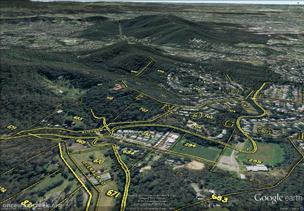
McKellar’s map also depicts part of Ithaca Creek, the catchment of which neighbours the Western Creek catchment. The picture below shows two branches of Ithaca Creek meeting near Carwoola Street. In the immediate foreground, under the name ‘Glenalbro’, you can see the roof of the old Freers chip factory. At the lower-right of the picture is Purtell Park, and right on top of it is the creek as it appears in McKellar’s map. I’ve know this spot for all of my life, but I never realised until now that the path of the creek had been changed to make way for the park.

Part of Ithaca Creek as depicted on McKellar's 1895 map. At the lower-right of the picture, the old path of the creek can be seen over Purtell Park.

Part of Ithaca Creek as depicted on McKellar’s 1895 map. At the lower-right of the picture, the old path of the creek can be seen over Purtell Park.

To explore McKellar’s map for yourself, all you need to do is download either of the following files and open it in Google Earth (you will need to download and install Google Earth first if you haven’t already). The first file shows McKellar’s map features in yellow but without any shadow effect. The second file is the same, but includes the shadow effect that you can see in the images above. The first file is much smaller and will load quicker, but some features on the map will not be as easy to see without the shadow.

Have fun!

Fun with Google Earth

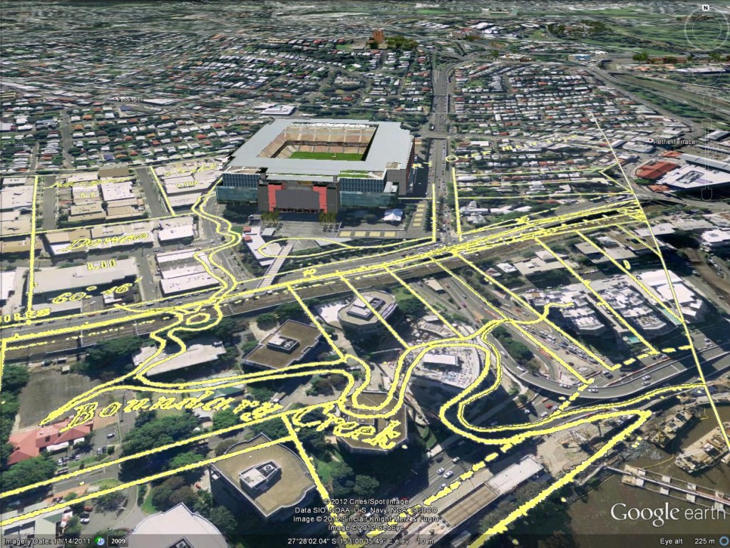
A few weeks back, I posted some images that I put together by combining old maps with recent aerial photographs. Since then, I’ve discovered how to import those same maps into Google Earth. This is really exciting, because it allows you to explore these maps in an interactive way. Instead of being stuck with an orthogonal ‘straight down’ view, you can move around and view things from any angle you choose. A gallery of examples is below. In these images are three different historical maps:

  • ‘Plan of the limits of the town of Brisbane’ (1843). You can see the original in the Queensland Historical Atlas.
  • ‘Plan of Portions 203 to 257 in the Environs of Brisbane, Parish of Enoggera, County of Stanley, New South Wales’ (1859). This is available at the Queensland State Archives (Item ID620656) and the State Library (Record 727379).
  • ‘Plan of Brisbane Water Works’ (1864). This map shows the pipeline route between Enoggera Reservoir and Brisbane City, and is available from the Brisbane City Council Archives.

Boundary Creek as depicted in 1864. In the foreground is the Coronation Drive Office Park, and behind it is Suncorp Stadium.

Boundary Creek as depicted on in 1864. In the foreground is the Coronation Drive Office Park, and behind it is Suncorp Stadium.


Continue reading

Fun with maps

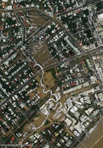
Western Creek as depicted on a map from 1859 (Queensland State Archives Item ID620656) overlaid on an aerial photograph of the January 2011 flood (Department of Natural Resouces & Mines)

Western Creek as depicted on a map from 1859 overlaid on an aerial photograph of the January 2011 flood

The banner at the top of this page features a depiction of Western Creek from A.R. McKellar’s 1895 map of Brisbane overlaid onto the modern suburban landscape. For me this captured the essence of what the site is about: gaining a deeper understanding the modern landscape though an exploration of its past. This graphic served its purpose, but I always knew that it was just a prototype for what could be achieved on a grander scale.

Now that I’ve collected a few more old maps, and discovered the free aerial photos taken during the 2011 flood (available from the Queensland Government Information Service), I have started to put the two together, and you can see the results on this hastily assembled new page: The lost creeks rise again. That page looks at how the floodzones from January 2011 in Milton and Auchenflower coincided with the location of old creeks, swamps and lagoons that have long been drained and buried. The image to the right (click to enlarge), which shows Western Creek between the river and Gregory Park, is one example.

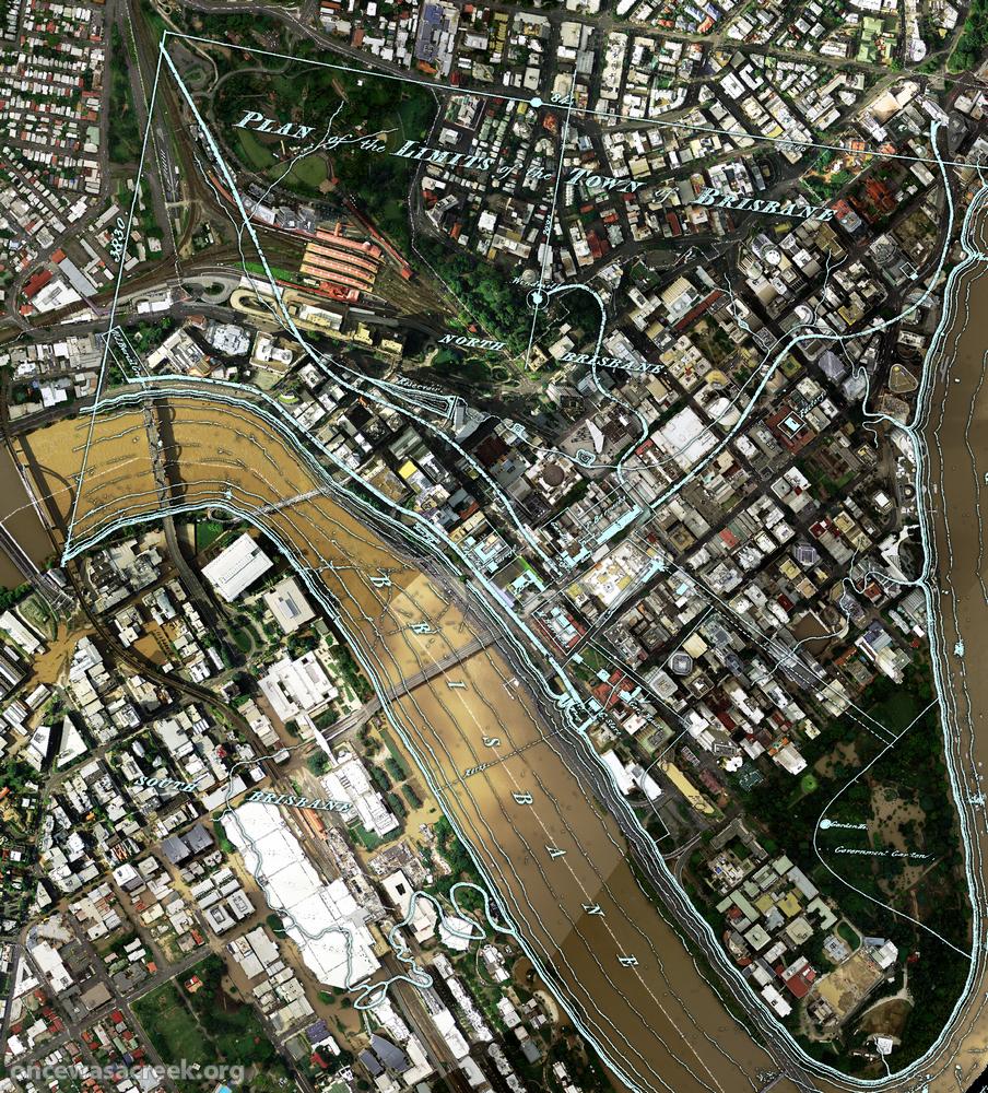
What you won’t find on that page is the image below, which shows the CBD area overlaid with a plan of Brisbane from 1843. There wasn’t much to Brisbane at that stage (it had only just ceased being a penal colony), but in addition to the few buildings and roads marked, there are some fascinating natural features on this map. For example, notice the creek that begins up in Spring Hill and flows down towards a small dam which is right on top of where the new law courts are today. This was Brisbane’s first water supply. The stream continues through a small pool at King George Square and flows to the river near Creek Street. Click here to see this part of the map in a bit more detail.

A plan of the town limits from 1843 overlaiad on an aerial photo from January 2011.

A plan of the town limits from 1843 overlaid on an aerial photo (Dept of Natural Resources and Mines) from January 2011.

Across the river, nothing is marked in South Brisbane except for a creek that winds through the Convention Centre and Southbank Parklands (where there are now artificial streams). This enlargement shows the area in more detail.

I plan to use images like this wherever I can in future pages on this site, so stay tuned for more in the near future. What I’d really love to see is this done for as many old maps as possible, and the results made publicly available as files that can be imported into GIS software, or even via platforms like Google Maps or NearMap. Combined with historical aerial photographs as well, it would be an absolute treasure trove for professional and armchair researchers alike. So, anyone got some funds?