The bird on the fence by the pond

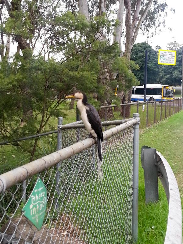
A waterbird sitting on the fence by the pond at the bottom of the Fernberg grounds

A waterbird sitting on the fence by the pond at the bottom of the Fernberg grounds

I walked past the pond at the bottom of the Fernberg grounds today and saw this bird sitting on the fence. It looks familiar but I have no idea what it is. I’ve never seen this sort of bird around here before.

It let me get surprisingly close — within a couple of metres. Even at that distance, this is the best I could do with the camera on my phone. Though it stayed in the one spot on the fence, it frequently moved its body, occasionally stretching out its long neck. When I finally got too close, the bird flew down into the pond, and proceeded to dive over and over again, seemingly combing the bottom with its beak, looking for things to eat. A very able diver, it reminded me a bit of a platypus.

It’s nice to know that this little restored remnant of Western Creek holds an attraction for wildlife in the area.

So… does anyone know what sort of bird it is?

The Mystery of the Cubberla Creek Campsite

Today I went up to the summit of Mount Coot-tha. It was another glorious, cloudless winter day, and while I did spend some time looking out over Brisbane while enjoying an ice cream, my main objective was to explore some of the walking tracks that begin from the summit and lead in various directions into the bush.

The Caladenia Creek
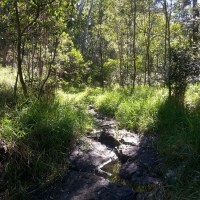
A small creek near the Lookout Trail leading from the summit of Mount Coot-tha towards Caladenia Street, Indooroopilly.

A small creek near the Lookout Trail leading from the summit of Mount Coot-tha towards Caladenia Street, Indooroopilly.

The first track I took was the Lookout Trail, which starts at the bottom of the carpark leading up to the cafe. After first following a gentle slope, this track quickly plummets at a perilously steep angle down towards Indooroopilly. The slope then eases again and the track heads along a slight ridge. To the left lies a residential estate, and to the right, a gully leading down to a rocky creek bed. The track and the creek then converge and come to an abrupt end top of Caladenia Street. The track gives way to a bitumen road, and the creek is swallowed up by a large drainpipe running beneath the road.
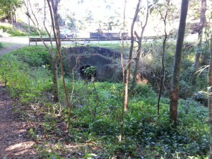
Where the bush becomes suburbia and the creek becomes a drain at Caladenia Street, Indooroopilly.

Where the bush becomes suburbia and the creek becomes a drain at Caladenia Street, Indooroopilly.

I’ve spent considerable time wandering around Western Creek trying to imagine what the landscape looked like before it was developed. It’s not easy to do, because so little bushland is left there except for a few patches around Government House and around Tristania Drive. But here at Caladenia Street, the before-and-after comparison couldn’t be easier. The past and the present are conveniently juxtaposed, divided neatly by a straight line. On one side there is the bush and creek, more or less as they always would have been; on the other side is the modified suburban landscape, bearing absolutely no resemblance to what it replaced.


Where the forest meets the suburb, at Caladenia Street, Indooroopilly. View Larger Map

Continue reading

What’s in the Governor’s backyard?

Last Sunday was open day at Government House, the big white mansion at the top of the hill on Fernberg Road. These events only happen once or twice a year, so they are a rare opportunity to see inside the Governor’s backyard — and the Governor’s house, of course, if that takes your fancy.

This was the first open day since I started working on this website (there would have been one on Australia Day but it was rained out), so I did not want to miss the chance to explore and photograph those parts of the grounds that you can’t see from the outside. Along with the weedy scrub up around Tristania Drive and Stuartholme, these grounds contain the only substantial remnant bush in the Western Creek catchment. They also contain three ponds (one natural, two artificial), some steep overgrown gullies and even (thanks to the wet weather) a running stream.

I’ve put the results of my little expedition in a new page called Fernberg from the inside (Fernberg, meaning ‘distant mountain’, is the name given to the property by its first owner, Johann Heussler). I’d be interested to know what other people think about the Fernberg grounds, and particularly whether they could be improved or made more accessible to the public.

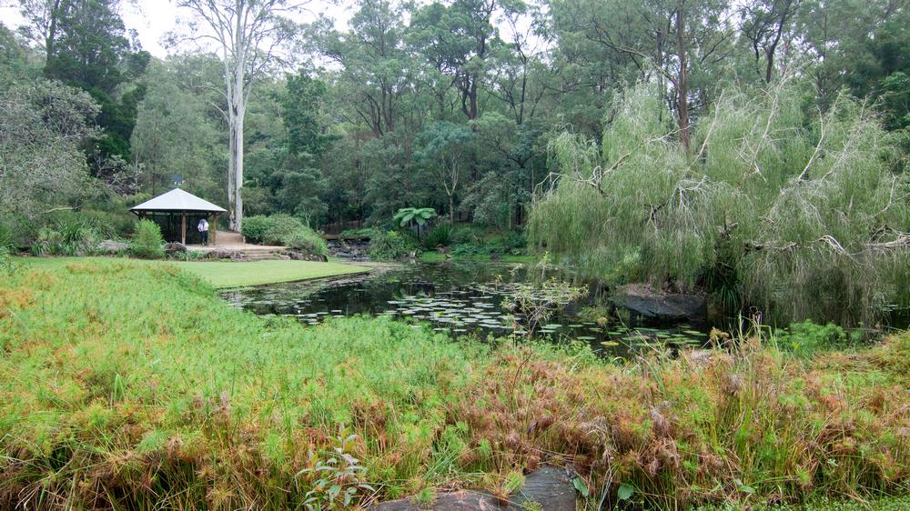
The lower of the two ornamental ponds at Fernberg

The lower of the two ornamental ponds at Fernberg

The swamp runneth over

Since starting this project, one thing I’ve been constantly looking out for is old maps. Unless there are some unpublished photos1 or drawings floating around (and I sincerely hope that there are), maps are the only visual record we have of the old Western Creek.

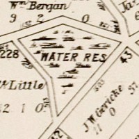
Looking at maps of Brisbane from the late 1800s and early 1900s, you can see the residential lots dissolve into singular paddocks, and the road networks dwindle to just a few major arteries. In the spaces that are left, you can often find details of the underlying landscape. The oldest maps sometimes depict slopes and ridges, some of which have since been reshaped or cut down. And in between the hills you will typically see an abundance of water features — not only rivers and creeks, but also swamps and ponds — that have long since been built over.

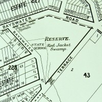
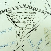
In the essay about the history of Gregory Park, I showed how the transition from Red Jacket Swamp to Gregory Park was depicted on maps from 1906, 1896 and 1884:

Queensland Surveyor General's Office (1884), Moreton 20 chains to an inch. Sheet 1B. National Library of Australia: http://trove.nla.gov.au/work/11526397

Present-day Gregory Park depicted in 1884.

Present-day Gregory Park as depicted on McKeller's map of Brisbane, 1895. (Brisbane City Council Archives)

Present-day Gregory Park depicted in 1895

Gregory Park depicted on a map published by the Queensland Department of Public Lands. The base map is dated 1906, but additional roads appear to have been added at a later date. (Brisbane City Council Archives)

Gregory Park depicted in 1906.


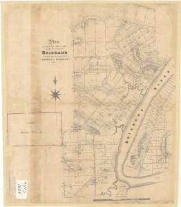
Plan of Portions 203 to 257 in the Environs of Brisbane, Parish of Enoggera, County of Stanley, New South Wales', 1859. (Queensland State Archives Item ID620656)

Plan of Portions 203 to 257 in the Environs of Brisbane, 1859. (Queensland State Archives Item ID620656)

Continue reading

Notes:

  1. In the State Library’s catalogue, there is a photos of the old Dunmore Bridge (where Coronation Drive crossed the mouth of the creek) and one of a sad looking ditch somewhere in the vicinity of Beck Street. These are the only photos I know of that show Western Creek. If you know of others, please get in touch with me!

Spreading the word

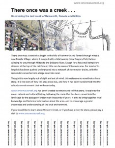
The oncewasacreek.org flyer. (Please download the PDFversion if you wish to use it.)

The oncewasacreek.org flyer. (Please download the PDFversion if you wish to use it.)

Having concentrated for so long on getting this site up and running and populating it with some content, I’ve recently turned my attention to getting the word out so that people might actually read it. That was, after all, the point of creating it in the first place.

Self-promotion has never come naturally to me, so I’m starting small. I’ve created a ‘flyer’ for the site that I have been posting around the neighbourhood on noticeboards, bus stops and the like. Perhaps you are here now because you stumbled across one of these.
If you would like to promote the site, and have (legitimate) access to a noticeboard or similar advertising space (perhaps in your workplace or school, for example), you are welcome to download and post the flyer. If you want to go that extra mile, you can even cut the tabs at the bottom so that they can be easily torn off.

Of course, you can always tell your friends, family and neighbours about the site the old-fashioned way as well!