Exploring McKellar’s map in Google Earth

The fun with maps continues…

As detailed in last week’s post, I have recently been experimenting with ways of importing historical maps into Google Earth, which enables them to be explored from a whole new perspective. I initially did this for three maps, dating from 1843, 1859 and 1864. Today I’ve done the same for another map — Sheet 7 from a series of maps drawn by the government lithographer A.R. McKellar in 1895. This map shows the Milton Reach of the river and the area to the west up to Mount Coot-tha. You can see what the original version of this map looks like at the Queensland Historical Atlas.

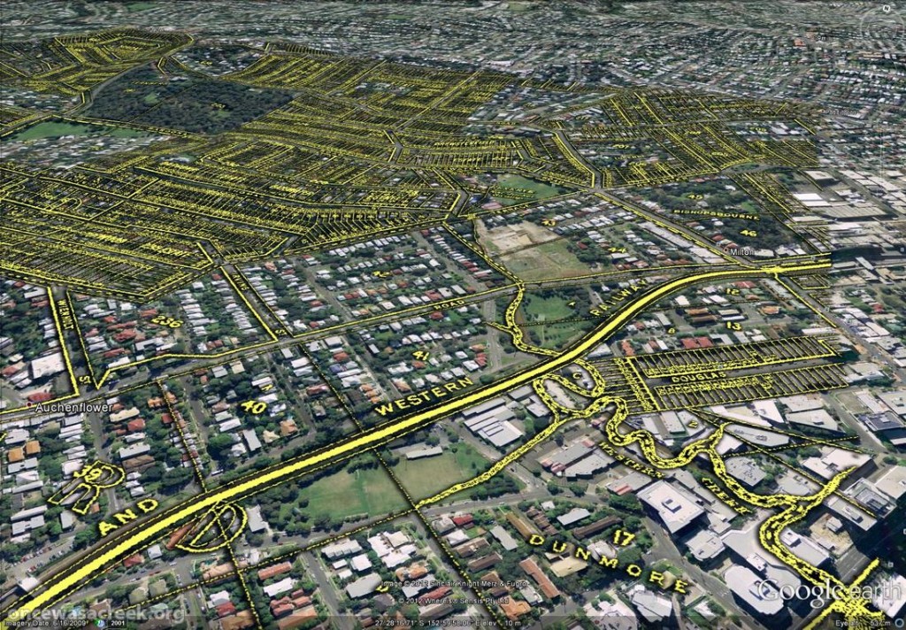
You would already be familiar with this map’s depiction of Western Creek — it is the one shown at the top of this page and all throughout this website. The picture below shows this same part of McKellar’s map in Google Earth. Dunmore Park is in the foreground, and Milton Park, Frew Park and Gregory Park can also be seen along the creek’s path.

Western Creek as depicted on McKellar's 1895 map, viewed in Google Earth.

Western Creek as depicted on McKellar’s 1895 map, viewed in Google Earth.

The image below shows the Toowong Cemetery. Beyond the cemetery, towards the upper right of the picture, is the area bounded by Boundary Road, Simpsons Road and Macgregor Terrace. This subcatchment of Western Creek is marked on McKeller’s map as the Lizzy Lee, Soudan and Rose Hill estates — names that all seem to have been lost, with the exception of Soudan Street. To the left of the cemetery, a ‘school reserve’ is marked on an area that is still bushland today.
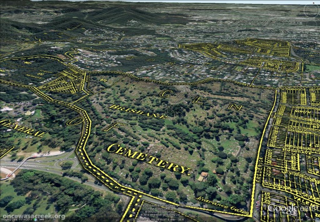
The Toowong Cemetery as depicted on McKellar’s 1895 map. Further in the distance are the Lizzy Lee, Soudan and Rose Hill estates.

The Toowong Cemetery as depicted on McKellar’s 1895 map. Further in the distance are the Lizzy Lee, Soudan and Rose Hill estates.

McKellar’s map also depicts part of Ithaca Creek, the catchment of which neighbours the Western Creek catchment. The picture below shows two branches of Ithaca Creek meeting near Carwoola Street. In the immediate foreground, under the name ‘Glenalbro’, you can see the roof of the old Freers chip factory. At the lower-right of the picture is Purtell Park, and right on top of it is the creek as it appears in McKellar’s map. I’ve know this spot for all of my life, but I never realised until now that the path of the creek had been changed to make way for the park.
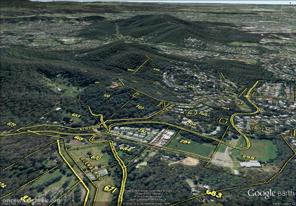
Part of Ithaca Creek as depicted on McKellar's 1895 map. At the lower-right of the picture, the old path of the creek can be seen over Purtell Park.

Part of Ithaca Creek as depicted on McKellar’s 1895 map. At the lower-right of the picture, the old path of the creek can be seen over Purtell Park.

To explore McKellar’s map for yourself, all you need to do is download either of the following files and open it in Google Earth (you will need to download and install Google Earth first if you haven’t already). The first file shows McKellar’s map features in yellow but without any shadow effect. The second file is the same, but includes the shadow effect that you can see in the images above. The first file is much smaller and will load quicker, but some features on the map will not be as easy to see without the shadow.

Have fun!

Fun with Google Earth

A few weeks back, I posted some images that I put together by combining old maps with recent aerial photographs. Since then, I’ve discovered how to import those same maps into Google Earth. This is really exciting, because it allows you to explore these maps in an interactive way. Instead of being stuck with an orthogonal ‘straight down’ view, you can move around and view things from any angle you choose. A gallery of examples is below. In these images are three different historical maps:

  • ‘Plan of the limits of the town of Brisbane’ (1843). You can see the original in the Queensland Historical Atlas.
  • ‘Plan of Portions 203 to 257 in the Environs of Brisbane, Parish of Enoggera, County of Stanley, New South Wales’ (1859). This is available at the Queensland State Archives (Item ID620656) and the State Library (Record 727379).
  • ‘Plan of Brisbane Water Works’ (1864). This map shows the pipeline route between Enoggera Reservoir and Brisbane City, and is available from the Brisbane City Council Archives.

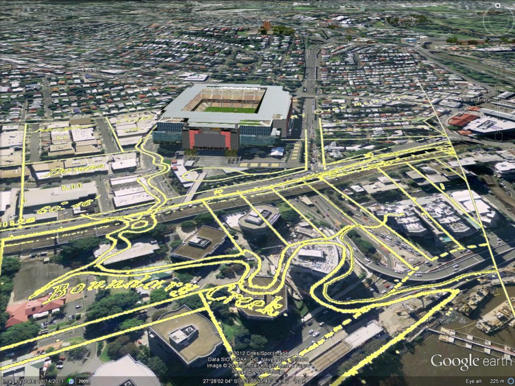
Boundary Creek as depicted in 1864. In the foreground is the Coronation Drive Office Park, and behind it is Suncorp Stadium.

Boundary Creek as depicted on in 1864. In the foreground is the Coronation Drive Office Park, and behind it is Suncorp Stadium.


Continue reading

Once upon a time in the west

The Milton area, as depicted on a map from 1859 as depicted on a map from 1859 (Queensland State Archives, Item ID620656), overlaid on Google Maps.

The Milton area, as depicted on a map from 1859 as depicted on a map from 1859 (Queensland State Archives, Item ID620656), overlaid on Google Maps.

I’ve finally finished a new page about the early estates of Milton.

This page focuses on the early land divisions in the Milton area, and the houses and farms built on them by the early landowners. It also goes back a bit further, touching on Brisbane’s beginnings as a penal settlement, and further still, revisiting John Oxley’s discovery of fresh water at Western Creek in 1824.

I’ve tried to bring the story to life with some historical photos of the Milton area from the State Library’s collection, as well as a wonderful account of the view from the River Road written by a contributor to the Moreton Bay Courier in 1859. I’ve also had some more fun with maps, combining features from a map from 1859 with modern-day aerial photos to show the early land holdings.

I intend to follow this page up with one looking at the subdivision of these early holdings into residential estates. To that end, I’ve already spent longer than I ever imagined possible reading 150-year-old real estate columns. The results, I hope, will appear in the not-too-distant future; but as usual, I would not recommend holding your breath!

Panorama from Dunmore Terrace, 1910. (State Library of Queensland, Negatives 183958, 183967 and 183958 and 183967)

Panorama from Dunmore Terrace, 1910. Chasely Street is on the right, running between the block where Chasely Apartments now stand, and the Moorlands Estate (now the Wesley Hospital) (State Library of Queensland, Negatives 183967, 183958 and 183970)

Fun with maps

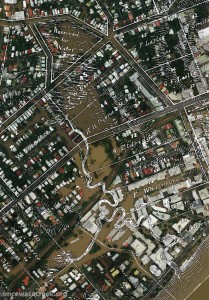
Western Creek as depicted on a map from 1859 (Queensland State Archives Item ID620656) overlaid on an aerial photograph of the January 2011 flood (Department of Natural Resouces & Mines)

Western Creek as depicted on a map from 1859 overlaid on an aerial photograph of the January 2011 flood

The banner at the top of this page features a depiction of Western Creek from A.R. McKellar’s 1895 map of Brisbane overlaid onto the modern suburban landscape. For me this captured the essence of what the site is about: gaining a deeper understanding the modern landscape though an exploration of its past. This graphic served its purpose, but I always knew that it was just a prototype for what could be achieved on a grander scale.

Now that I’ve collected a few more old maps, and discovered the free aerial photos taken during the 2011 flood (available from the Queensland Government Information Service), I have started to put the two together, and you can see the results on this hastily assembled new page: The lost creeks rise again. That page looks at how the floodzones from January 2011 in Milton and Auchenflower coincided with the location of old creeks, swamps and lagoons that have long been drained and buried. The image to the right (click to enlarge), which shows Western Creek between the river and Gregory Park, is one example.

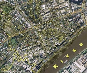
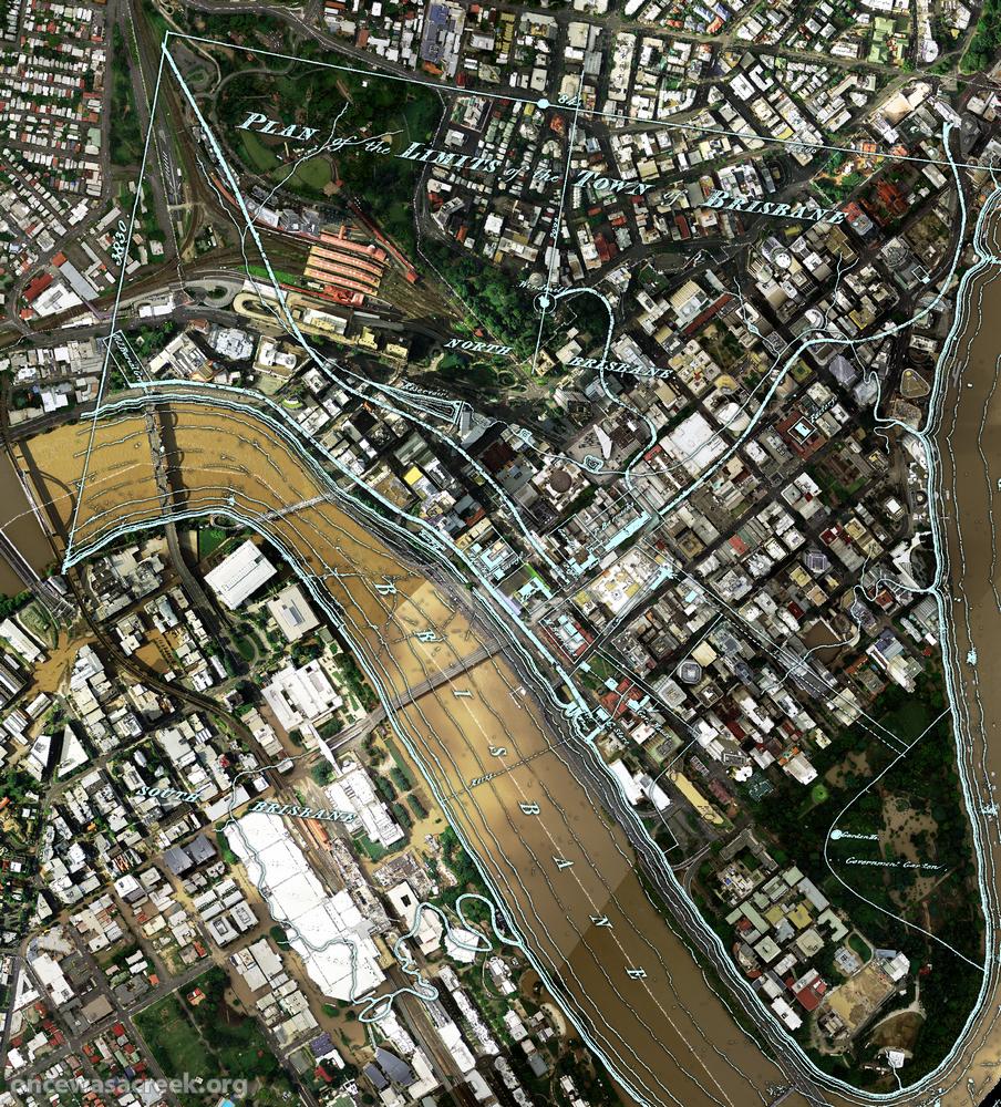
What you won’t find on that page is the image below, which shows the CBD area overlaid with a plan of Brisbane from 1843. There wasn’t much to Brisbane at that stage (it had only just ceased being a penal colony), but in addition to the few buildings and roads marked, there are some fascinating natural features on this map. For example, notice the creek that begins up in Spring Hill and flows down towards a small dam which is right on top of where the new law courts are today. This was Brisbane’s first water supply. The stream continues through a small pool at King George Square and flows to the river near Creek Street. Click here to see this part of the map in a bit more detail.

A plan of the town limits from 1843 overlaiad on an aerial photo from January 2011.

A plan of the town limits from 1843 overlaid on an aerial photo (Dept of Natural Resources and Mines) from January 2011.

Across the river, nothing is marked in South Brisbane except for a creek that winds through the Convention Centre and Southbank Parklands (where there are now artificial streams). This enlargement shows the area in more detail.

I plan to use images like this wherever I can in future pages on this site, so stay tuned for more in the near future. What I’d really love to see is this done for as many old maps as possible, and the results made publicly available as files that can be imported into GIS software, or even via platforms like Google Maps or NearMap. Combined with historical aerial photographs as well, it would be an absolute treasure trove for professional and armchair researchers alike. So, anyone got some funds?

Let’s talk about the weather

A new page is coming soon, I promise! But while that is still in the wings, I thought this would be as good time as any to talk about the weather. Can anyone remember when it last rained? I can’t either, but according to the Bureau of Meteorology’s records, it was the 19th of July.1

Daily rainfall data from the Bureau of Meteorology (station 040913)

Daily rainfall data from the Bureau of Meteorology (station 040913)

That’s 45 consecutive rainless days, with more likely to come (the current forecast for each of the next seven days is “Fine, mostly sunny”). For the most part, the lawns and trees around the place aren’t looking too parched just yet — no doubt thanks to the relatively good rainfall we enjoyed during the first half of the year. But there are some clear signs that the landscape is drying up. A really good example is the pond straddling the bottom of Norman Buchan Park and the Government House grounds. Here’s what it looked like back in October of last year:

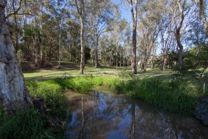
The pond on the Fernberg grounds

The pond on the Fernberg grounds (Government House), October 2011

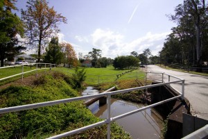
The pond by the culvert under Baroona Road at Norman Buchan Park

The pond by the culvert under Baroona Road at Norman Buchan Park, October 2011


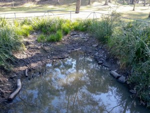
And here’s what it looked like as I passed by this morning on my way to the markets (note that I did not take these with a before-and-after comparison in mind, so the angles are different to the previous photos):

The pond at the bottom of the Fernberg grounds, 2 September, 2012.

The pond at the bottom of the Fernberg grounds, 2 September, 2012.

The pond at Norman Buchan Park, 2 September, 2012.

The pond at Norman Buchan Park, 2 September, 2012.


On the Norman Buchan Park side, there is but one small puddle remaining, while on the Fernberg side the water level has dropped significantly. How long before it dries out completely? I’ve been told by one keen observer that this pond did not completely dry up even during the millennium drought, which lasted from around 1997 until 2009.2 If that is the case then it seems likely that the pond receives water from a source other than the surface drainage from the surrounding hills. One possibility is that it is fed by an underground spring. This theory is lent weight by historical anecdotes such as J.C Heussler’s letter to the Lands Department in 1864 describing a permanent spring nearby, and John Oxley’s discovery in 1824 of a chain of ponds in the area in the midst of another severe drought (see here and here for more about Heussler’s and Oxley’s reports).

I hope the current dry spell does not last too much longer. But if it hasn’t rained before next Sunday, I’ll be sure to have another look on my way to the markets.

Notes:

  1. I’m not counting the 0.2mm that was recorded on 20 July or 1 September. These data are available from the Bureau’s web site.
  2. See here and here for some more information about the drought.