The history of the Coronation Drive Office Park

This post is all about the part of Milton bounded by the railway, Cribb Street, Coronation Drive and Boomerang Street. If you live in Brisbane, it’s a place that you have probably passed many times without really noticing. From Coronation Drive it presents as a row of office buildings and some Jacarandas; from the train, as a car park and some Moreton Bay figs. From within, the site feels like a secluded, shady village. Interspersed with the eight office buildings and fig trees are a tennis court, a childcare centre, a multi-level carpark, an open carpark, cafes, and various shops including a Flight Centre and a real estate office. This site is known (to those who know it as anything at all) as the Coronation Drive Office Park.

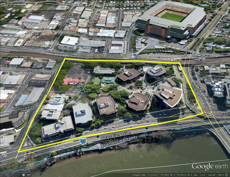
The Coronation Drive Office Park is bounded by Cribb Street, the railway line, Boomerang Street and Coronation Drive.

The Coronation Drive Office Park covers 4.5 hectares and is bounded by Cribb Street, the railway line, Boomerang Street and Coronation Drive.

AMP Capital, which manages of the majority of the site,1 are considering the next stage of its development. Before commencing this development, AMP Capital wanted to learn more about the site’s past. They asked me if I would like to do some research, and I jumped at the opportunity. After several weeks plumbing the depths of Trove, the Brisbane City Archives and various other sources, I produced a report documenting the history of the Coronation Drive Office Park.

You can download the report here (it’s about 13MB — apologies for the big download), but for a shorter, more web-friendly version of the story, read on below. Continue reading

Notes:

  1. Except for half a hectare at the corner of Coronation Drive and Cribb Street, the site is owned by AMP and Sunsuper.

Western Creek on display

A few months ago I moved out of Rosalie and the catchment of Western Creek. I didn’t want to leave, but such is the plight of a renter. I now am a citizen of Oxley Creek, which runs through my new neighbourhood of Rocklea.

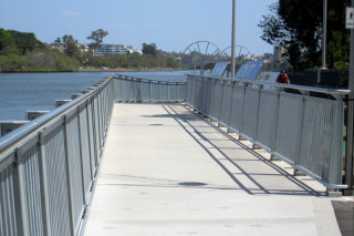
So these days I am writing about Western Creek from a bit of a distance. I no longer get to notice the day-to-day changes that happen in the area, like the height of the pond at Norman Buchan Park, the movement of the heaps of dirt in Frew Park, and the state of the new footbridge being built along the bikeway at the mouth of Western Creek.

The new footbridge alongside the bikeway over the mouth of Western Creek (photo by Steven Cowley).

The new footbridge alongside the bikeway over the mouth of Western Creek (photo by Steven Cowley).

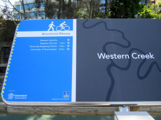
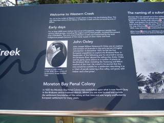
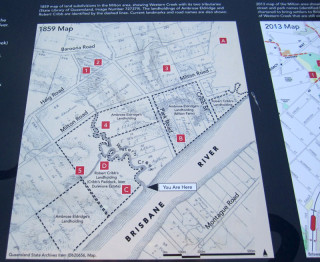
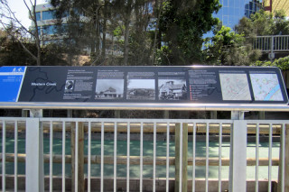
Luckily there are locals still keeping an eye out for me. A few days ago I learned from Steven Cowley that the footbridge has been completed. To our delight and surprise, the new bridge includes two large educational signs dedicated to the history of Western Creek and its surrounds. The first inhabitants, John Oxley’s arrival, the development of Milton, and the three creeks and bridges of the Milton Reach, are all covered. Accompanying the text are several large photographs from the State Library’s collection, and some maps illustrating the location of past and present landmarks, including Western Creek and Red Jacket Swamp.

It is rather beautifully done, and I am quite touched to see the effort that the council (and/or the state government) has made to promote the history of Western Creek and the Milton Reach. I hope that we will see more of these sorts of signs in Brisbane in the future.

(photo by Steven Cowley)

One of the signs on the new footbridge (photo by Steven Cowley)

(photo by Steven Cowley)

Welcome to Western Creek (photo by Steven Cowley)


(photo by Steven Cowley)

A map on one of the signs, showing past and present landmarks (photo by Steven Cowley)

(photo by Steven Cowley)

One of the two educational signs on the new footbridge (photo by Steven Cowley)

Uncovering Langsville Creek — Part 1

This is the first in a series of posts about Langsville Creek, which was Western Creek’s upstream neighbour on the Toowong/Milton Reach. I do not intend to research Langsville Creek fully at this stage, as I have too much still to learn about Western Creek. But I couldn’t resist tracing the path of this (mostly) lost creek and seeing what can be learned by looking at the some of the old maps and aerial photographs. Each post will look at a different part of Langsville Creek. This one focuses on the lowest reaches of the creek, near where it met the Brisbane River. You can also now read Part 2 and Part 3 of the series.

The meanders of Moorlands

Toowong Cemetery … Anzac Park … the Mount Coot-tha Botanical Gardens … Quinn Park … the McIlwraith Croquet Club … Toowong Memorial Park … Moorlands Park.

What do all of these places have in common? The answer is a creek. Not a creek you are likely to have seen or heard of, for there are few traces of it left today. But there once was a creek that flowed through all of these locations.

The creek uniting these locations was known to early Brisbanites as Langsville Creek, though I imagine that it also had names given to it by the Turrbal people long before Europeans arrived. I’ve not read up on how and when it came to be known as Langsville Creek, but given that just about everything else in this part of Brisbane is named after John Dunmore Lang, I’m going to take a punt and guess that this creek was as well.

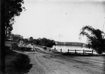
Langsville Bridge at Auchenflower, ca.1910. (State Library of Queensland, Negative no. 118279)

Langsville Bridge at Auchenflower, ca.1910. (State Library of Queensland, Negative no. 118279)

You can see Langsville Creek — or at least part of it — on the early maps of Brisbane. It’s depicted most clearly on McKellar’s 1895 map, the relevant portion of which is reproduced below. The creek itself is unnamed on this map, except by way of the bridge that crosses it where Patrick Lane meets the River Road (now Coronation Drive). The creek looks rather like an outgrowth of the river, as if the river has put out tentacles or feelers, each one meandering through the landscape much as the river winds its way to the bay. The land surrounding it appears to be mostly undeveloped, presumably because it was damp and flood-prone.

Continue reading

John Oxley Centre Fail

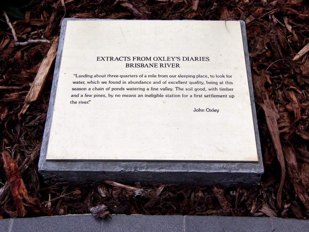
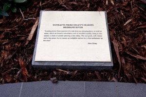
A plaque in the old courtyard of the John Oxley Centre, comemmorating Oxley's landing at Western Creek.

A plaque in the old courtyard of the John Oxley Centre, comemmorating Oxley’s landing at Western Creek.

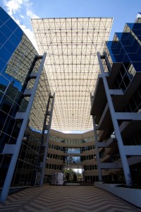
Back in April 2012 I posted about the renovations of the big courtyard in between the two office towers of the John Oxley Centre on Coronation Drive. This courtyard sits more or less on top of the old stream of Western Creek (now Milton Drain) just before it met the river. It is quite likely where John Oxley came ashore in 1824 to look for fresh water, which he found in abundance somewhere along Western Creek.

In the gardens of the old courtyard there were plaques engraved with excerpts of John Oxley’s diary describing his landing here in 1824. I wondered if these might somehow survive the renovations, or if some other homage to Oxley’s landing might replace them.
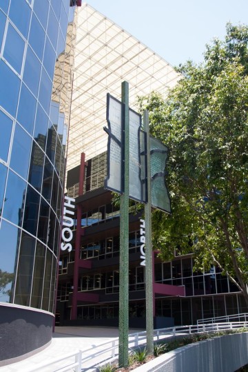
The two 'signposts' at the entrance to the newly renovated John Oxley Centre.

The two ‘signposts’ at the entrance to the newly renovated John Oxley Centre.

Last weekend I finally got around to seeing how it has all turned out. The whole space has been given a facelift to give it a more ‘modern’ look and feel. (To my mind it was hardly worth it, but hey, that’s not my call to make.) The plaques are gone, but Oxley’s landing has not been forgotten. Unfortunately though, the effort to commemorate it could hardly be described as successful.

As you approach the courtyard from Coronation Drive, you might notice these two oddly shaped steel plates affixed to two intricately marked square poles. Or more accurately, there are four plates, each fixed to opposite sides of the poles to give the impression of two distinct shapes. What are they meant to be? Flags? Signposts? There is black trimming running around the outline of the plates, and also diagonally across them. On one of the plates, half of the diagonal line already appears to have fallen off, leaving a smear of glue. Is this supposed to be the outline of the river? The creek, perhaps?

Now, if you stand beneath the plates (they are about two and a half metres above the ground) and look closely, and if the light strikes them at just the right angle, you might just be able to see that there are letters embossed on them:
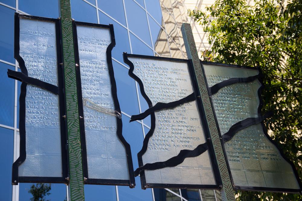
The two ... erm, 'pages' on the posts outside the John Oxley Centre.

The two … erm, ‘pages’ on the posts outside the John Oxley Centre.

Aha! This must be it! Sure enough, at the top of the two ‘skinny’ plates are the words “TUESDAY SEPTEMBER 28TH 1824” (all written in uppercase). The words continue, but reading them is a challenge because they are interrupted by the post and the black trimming running right through the middle of the ‘page’ (ahhh… so perhaps the shape is meant suggest a scrappy page out of Oxley’s diary!?). They run something like this:

A CALM … NIGHT
LANDING A…T THREE
QUARTERS…MILE FROM
OUR SLEE… PLACE.
TO LOOK…WATER,
WHICH WE…UND IN
NDANC…ND OF
…ALITY.
BEIN…S SEASON
A CHAIN…ONDS
WATERING…VALLEY

Eventually it culminates at the famous reference to a “FIRST SETTLEME…P THE RIVER”.

I knew what I was looking for. I visited the place with the specific aim of seeing how Oxley’s diary had been reflected in the new courtyard. I only noticed these posts because I was looking for something, and I only noticed that there was writing on them because I was looking for that too. And had I not already been familiar with this particular diary entry, I wouldn’t have had the foggiest idea what the words were trying to say, or where they came from.

So much for the skinny post. What about the fat one with the river running across it? I don’t even know. Even by zooming in on my photo I can only read half of it. Maybe it’s another page from Oxley’s diary. Or maybe it’s from another document describing the area. As far as I could tell, there was nothing to provide an explanation (perhaps I just didn’t look hard enough).

I honestly can’t view this installation as anything other than a dismal failure. It accomplishes virtually nothing, except to cause confusion to anyone who happens to notice it in the first place. If someone unfamiliar with the story of Oxley’s landing can look at it and deduce something about the history of this site, and the reason for the building’s name, then I take my hat off to them.

Or have I missed something?
John Oxley Centre Renovations

The courtyard of the John Oxley Centre, Coronation Drive, Decmber 2012

The courtyard of the John Oxley Centre, Coronation Drive, Decmber 2012

I took a walk down to the river this afternoon, and noticed that the John Oxley Centre, the office block standing over the mouth of Milton Drain, is undergoing some pretty substantial renovations. The courtyard, in which there used to be gardens featuring plaques engraved with excerpts from John Oxley’s fieldbook describing his landing hereabouts in 1824, has been completely gutted, the pavement and gardens all torn out.

I’d been meaning to get back there and photograph those plaques more thoroughly, but it looks like I might have missed my chance. That is, unless they are incorporated into the redeveloped courtyard. I thought those plaques were a nice touch, some small consolation for the fact that an office block now has been built over the lowest reach of this historic creek. It would be a shame if the some acknowledgement of the Creek and/or John Oxley’s landing is not featured in the new development.

Does anyone know the purpose of the renovations, or what we can expect to see when they are complete?

An extract from John Oxley's field book in the courtyard at the John Oxley Centre

An extract from John Oxley's field book in the courtyard at the John Oxley Centre