Exploring McKellar’s map in Google Earth

The fun with maps continues…

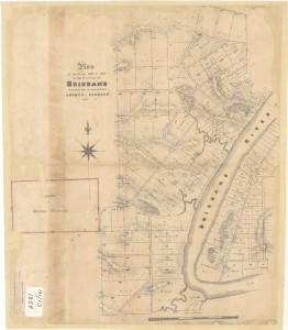
As detailed in last week’s post, I have recently been experimenting with ways of importing historical maps into Google Earth, which enables them to be explored from a whole new perspective. I initially did this for three maps, dating from 1843, 1859 and 1864. Today I’ve done the same for another map — Sheet 7 from a series of maps drawn by the government lithographer A.R. McKellar in 1895. This map shows the Milton Reach of the river and the area to the west up to Mount Coot-tha. You can see what the original version of this map looks like at the Queensland Historical Atlas.

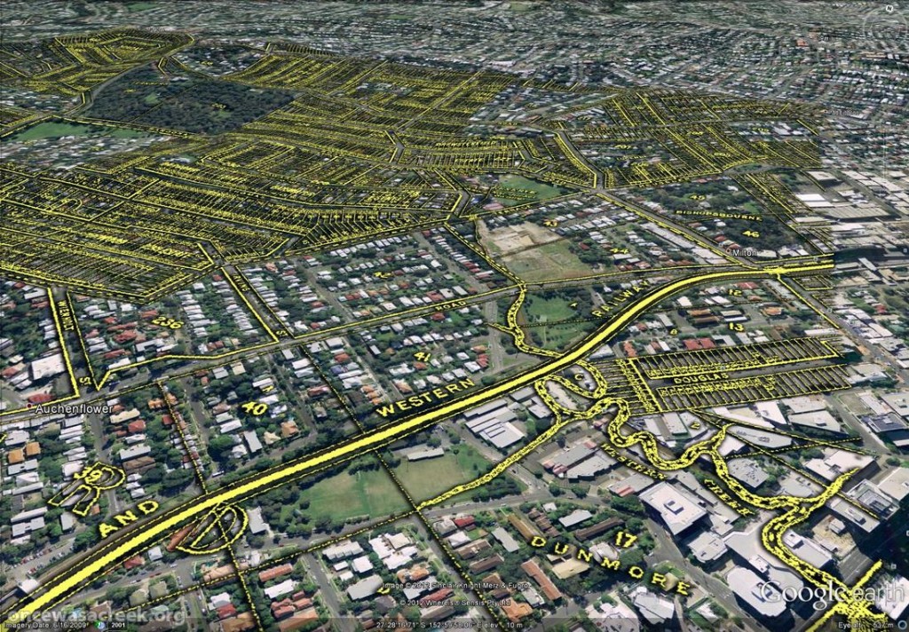
You would already be familiar with this map’s depiction of Western Creek — it is the one shown at the top of this page and all throughout this website. The picture below shows this same part of McKellar’s map in Google Earth. Dunmore Park is in the foreground, and Milton Park, Frew Park and Gregory Park can also be seen along the creek’s path.

Western Creek as depicted on McKellar's 1895 map, viewed in Google Earth.

Western Creek as depicted on McKellar’s 1895 map, viewed in Google Earth.

The image below shows the Toowong Cemetery. Beyond the cemetery, towards the upper right of the picture, is the area bounded by Boundary Road, Simpsons Road and Macgregor Terrace. This subcatchment of Western Creek is marked on McKeller’s map as the Lizzy Lee, Soudan and Rose Hill estates — names that all seem to have been lost, with the exception of Soudan Street. To the left of the cemetery, a ‘school reserve’ is marked on an area that is still bushland today.
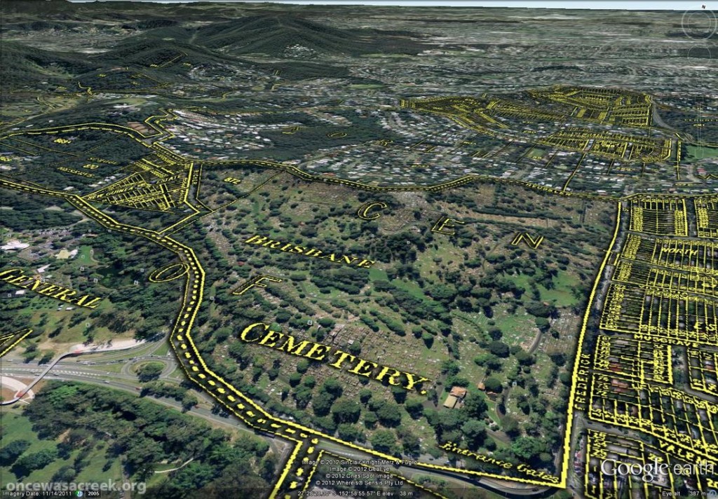
The Toowong Cemetery as depicted on McKellar’s 1895 map. Further in the distance are the Lizzy Lee, Soudan and Rose Hill estates.

The Toowong Cemetery as depicted on McKellar’s 1895 map. Further in the distance are the Lizzy Lee, Soudan and Rose Hill estates.

McKellar’s map also depicts part of Ithaca Creek, the catchment of which neighbours the Western Creek catchment. The picture below shows two branches of Ithaca Creek meeting near Carwoola Street. In the immediate foreground, under the name ‘Glenalbro’, you can see the roof of the old Freers chip factory. At the lower-right of the picture is Purtell Park, and right on top of it is the creek as it appears in McKellar’s map. I’ve know this spot for all of my life, but I never realised until now that the path of the creek had been changed to make way for the park.
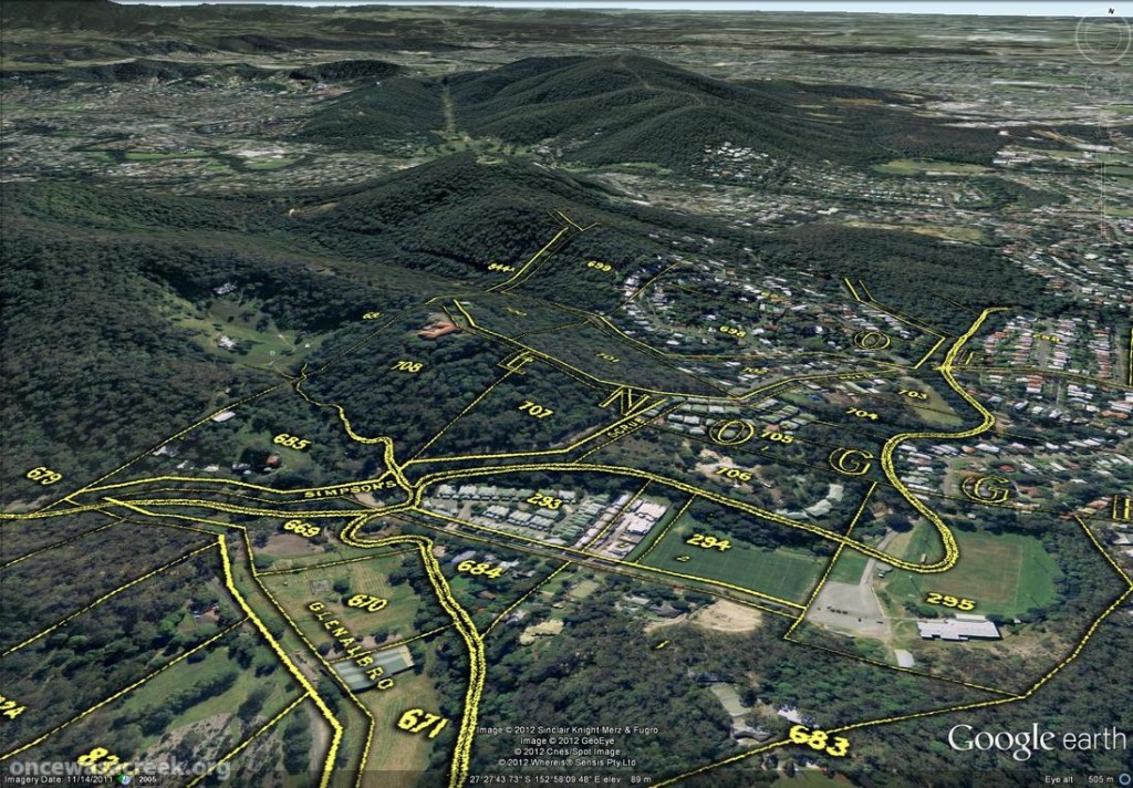
Part of Ithaca Creek as depicted on McKellar's 1895 map. At the lower-right of the picture, the old path of the creek can be seen over Purtell Park.

Part of Ithaca Creek as depicted on McKellar’s 1895 map. At the lower-right of the picture, the old path of the creek can be seen over Purtell Park.

To explore McKellar’s map for yourself, all you need to do is download either of the following files and open it in Google Earth (you will need to download and install Google Earth first if you haven’t already). The first file shows McKellar’s map features in yellow but without any shadow effect. The second file is the same, but includes the shadow effect that you can see in the images above. The first file is much smaller and will load quicker, but some features on the map will not be as easy to see without the shadow.

Have fun!

Fun with Google Earth

A few weeks back, I posted some images that I put together by combining old maps with recent aerial photographs. Since then, I’ve discovered how to import those same maps into Google Earth. This is really exciting, because it allows you to explore these maps in an interactive way. Instead of being stuck with an orthogonal ‘straight down’ view, you can move around and view things from any angle you choose. A gallery of examples is below. In these images are three different historical maps:

  • ‘Plan of the limits of the town of Brisbane’ (1843). You can see the original in the Queensland Historical Atlas.
  • ‘Plan of Portions 203 to 257 in the Environs of Brisbane, Parish of Enoggera, County of Stanley, New South Wales’ (1859). This is available at the Queensland State Archives (Item ID620656) and the State Library (Record 727379).
  • ‘Plan of Brisbane Water Works’ (1864). This map shows the pipeline route between Enoggera Reservoir and Brisbane City, and is available from the Brisbane City Council Archives.

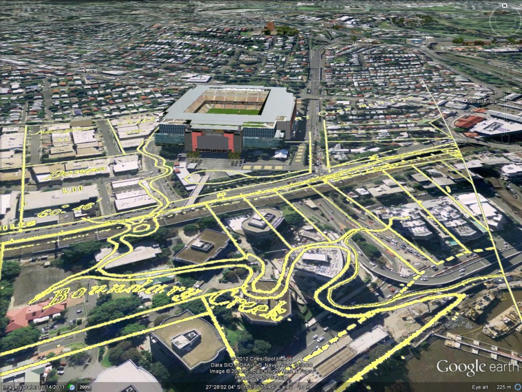
Boundary Creek as depicted in 1864. In the foreground is the Coronation Drive Office Park, and behind it is Suncorp Stadium.

Boundary Creek as depicted on in 1864. In the foreground is the Coronation Drive Office Park, and behind it is Suncorp Stadium.


Continue reading

There once was a waterhole . . .

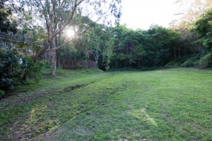
What do kids, cows and nuns have in common? The answer is Western Creek — a special part of Western Creek that no longer exists. For at the bottom of Couldrey Street, where there now is just a clearing, there once was a waterhole! As recently as the late 1970s or early 1980s, this was the local Wet-n-Wild for the neighbourhood kids, at least when there was enough rain to get the creek flowing through the bush. Going further back, before the suburb had fully moved in, the pond was used as a swimming hole by the nuns at Stuartholme when they ventured down to fetch the convent milk.

The clearing at the bottom of Couldrey Street

The clearing at the bottom of Couldrey Street

This is just the kind of story I was hoping to uncover when I started this website. And I owe it to Jonathon Freer, who is an ex-resident of Couldrey Street, and his mum Di, who still lives there in the house where Jonathon grew up. You can read all about it on this new page.

There must be other past and present residents of Couldrey Street out there who have stores and (I’m hoping) photographs to share about the waterhole and surrounding creek. If this is you, please get in touch with me!

The swamp runneth over

Since starting this project, one thing I’ve been constantly looking out for is old maps. Unless there are some unpublished photos1 or drawings floating around (and I sincerely hope that there are), maps are the only visual record we have of the old Western Creek.

Looking at maps of Brisbane from the late 1800s and early 1900s, you can see the residential lots dissolve into singular paddocks, and the road networks dwindle to just a few major arteries. In the spaces that are left, you can often find details of the underlying landscape. The oldest maps sometimes depict slopes and ridges, some of which have since been reshaped or cut down. And in between the hills you will typically see an abundance of water features — not only rivers and creeks, but also swamps and ponds — that have long since been built over.

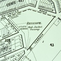
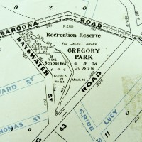
In the essay about the history of Gregory Park, I showed how the transition from Red Jacket Swamp to Gregory Park was depicted on maps from 1906, 1896 and 1884:

Queensland Surveyor General's Office (1884), Moreton 20 chains to an inch. Sheet 1B. National Library of Australia: http://trove.nla.gov.au/work/11526397

Present-day Gregory Park depicted in 1884.

Present-day Gregory Park as depicted on McKeller's map of Brisbane, 1895. (Brisbane City Council Archives)

Present-day Gregory Park depicted in 1895

Gregory Park depicted on a map published by the Queensland Department of Public Lands. The base map is dated 1906, but additional roads appear to have been added at a later date. (Brisbane City Council Archives)

Gregory Park depicted in 1906.


Plan of Portions 203 to 257 in the Environs of Brisbane, Parish of Enoggera, County of Stanley, New South Wales', 1859. (Queensland State Archives Item ID620656)

Plan of Portions 203 to 257 in the Environs of Brisbane, 1859. (Queensland State Archives Item ID620656)

Continue reading

Notes:

  1. In the State Library’s catalogue, there is a photos of the old Dunmore Bridge (where Coronation Drive crossed the mouth of the creek) and one of a sad looking ditch somewhere in the vicinity of Beck Street. These are the only photos I know of that show Western Creek. If you know of others, please get in touch with me!

John Oxley Centre Renovations

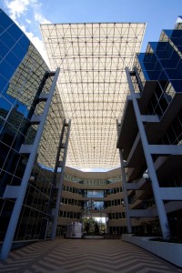
The courtyard of the John Oxley Centre, Coronation Drive, Decmber 2012

The courtyard of the John Oxley Centre, Coronation Drive, Decmber 2012

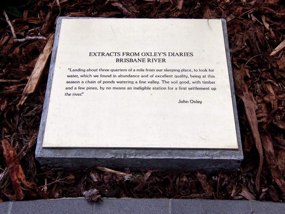
I took a walk down to the river this afternoon, and noticed that the John Oxley Centre, the office block standing over the mouth of Milton Drain, is undergoing some pretty substantial renovations. The courtyard, in which there used to be gardens featuring plaques engraved with excerpts from John Oxley’s fieldbook describing his landing hereabouts in 1824, has been completely gutted, the pavement and gardens all torn out.

I’d been meaning to get back there and photograph those plaques more thoroughly, but it looks like I might have missed my chance. That is, unless they are incorporated into the redeveloped courtyard. I thought those plaques were a nice touch, some small consolation for the fact that an office block now has been built over the lowest reach of this historic creek. It would be a shame if the some acknowledgement of the Creek and/or John Oxley’s landing is not featured in the new development.

Does anyone know the purpose of the renovations, or what we can expect to see when they are complete?

An extract from John Oxley's field book in the courtyard at the John Oxley Centre

An extract from John Oxley's field book in the courtyard at the John Oxley Centre